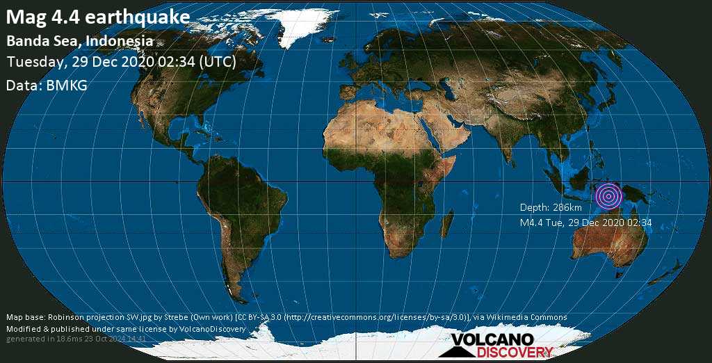
Light magnitude 4.4 earthquake at 286 km depth
29 Dec 02:41 UTC: First to report: EMSC after 7 minutes.
29 Dec 02:45: Now using data updates from BMKG
29 Dec 09:45: Hypocenter depth recalculated from 265.0 to 286.0 km (from 165 to 178 mi). Epicenter location corrected by 2.5 km (1.5 mi) towards NNW.
I felt this quake
I didn't feel it
Local time at epicenter: Tuesday, 29 Dec 11:34 am (GMT +9)
Magnitude: 4.4
Depth: 286.0 km
Epicenter latitude / longitude: 6.83°S / 128.08°E
Nearest volcano: Wurlali (71 km / 44 mi)
Nearby towns and cities:
223 km (138 mi) NNE of Lospalos (Timor-Leste) (pop: 17,200) --> See nearby quakes!
256 km (159 mi) NE of Baucau (Timor-Leste) (pop: 16,000) --> See nearby quakes!
275 km (171 mi) NE of Venilale (Timor-Leste) (pop: 16,000) --> See nearby quakes!
337 km (209 mi) NE of Delhi (Timor-Leste) (pop: 150,000) --> See nearby quakes!
349 km (217 mi) S of Ambon City (pop: 355,600) --> See nearby quakes!
399 km (248 mi) SSW of Amahai (pop: 47,700) --> See nearby quakes!
433 km (269 mi) NE of Atambua (Kabupaten Belu) (pop: 35,800) --> See nearby quakes!
492 km (306 mi) NE of Kefamenanu (Kabupaten Timor Tengah Utara) (pop: 29,500) --> See nearby quakes!
534 km (332 mi) WSW of Tual (pop: 39,500) --> See nearby quakes!
2347 km (1459 mi) E of Jakarta (pop: 8,540,100) --> See nearby quakes!
74 km (46 mi) NW of Pulau Terbang Utara Island --> See nearby quakes!
Weather at epicenter at time of quake:
Overcast Clouds 28.9°C (84 F), humidity: 75%, wind: 4 m/s (7 kts) from W
Primary data source: BMKG
Overcast Clouds
 28.9°C (84 F), humidity: 75%, wind: 4 m/s (7 kts) from W
Estimated released energy: 2.5 x 10¹¹ joules (69.8 megawatt hours, equivalent to 60 tons of TNT) More info

[smaller] [bigger]
If you felt this quake (or if you were near the epicenter), please share your experience and submit a short "I felt it" report! Other users would love to hear about it!
Also if you did NOT feel the quake although you were in the area, please report it! Your contribution is valuable also to earthquake science and earthquake hazard analysis and mitigation efforts. You can use your device location or the map to indicate where you were during the earthquake. Thank you!
Also if you did NOT feel the quake although you were in the area, please report it! Your contribution is valuable also to earthquake science and earthquake hazard analysis and mitigation efforts. You can use your device location or the map to indicate where you were during the earthquake. Thank you!
Data for the same earthquake reported by different agencies
Info: The more agencies report about the same quake and post similar data, the more confidence you can have in the data. It takes normally up to a few hours until earthquake parameters are calculated with near-optimum precision.
| Magnitude | Depth | Location | Source |
| M 4.4 | 286 km | Banda Sea, Indonesia | BMKG |
| M 4.4 | 265 km | BANDA SEA, Indonesia | EMSC |
User reports for this quake
There are no user reports for this quake yet. If you felt it be the first to report it!
Earlier earthquakes in the same area since 1900
Mag. 4.4 earthquake - Banda Sea, 74 km northwest of Pulau Terbang Utara Island, Maluku, Indonesia, on Tuesday, 29 Dec 11:34 am (GMT +9)Map of earlier quakes
https://news.google.com/__i/rss/rd/articles/CBMibmh0dHBzOi8vd3d3LnZvbGNhbm9kaXNjb3ZlcnkuY29tL2VhcnRocXVha2VzL3F1YWtlLWluZm8vNjAzOTc1Ni9tYWc0cXVha2UtRGVjLTI5LTIwMjAtQkFOREEtU0VBLUluZG9uZXNpYS5odG1s0gEA?oc=5
2020-12-29 02:34:00Z
Tidak ada komentar:
Posting Komentar